Eastlink Business Park Conceptual Scheme

Welcome to
Eastlink Business Park

Welcome to Eastlink Business Park

A Conceptual Scheme and Land Use Amendment application have been submitted to support future development
of a master-planned, fully serviced industrial business park in East Balzac, Rocky View County.

Public Hearing Update:

Rocky View County Council will consider the Eastlink Business Park Conceptual Scheme and Land Use Amendment applications at a public hearing on [date pending].

Our Vision

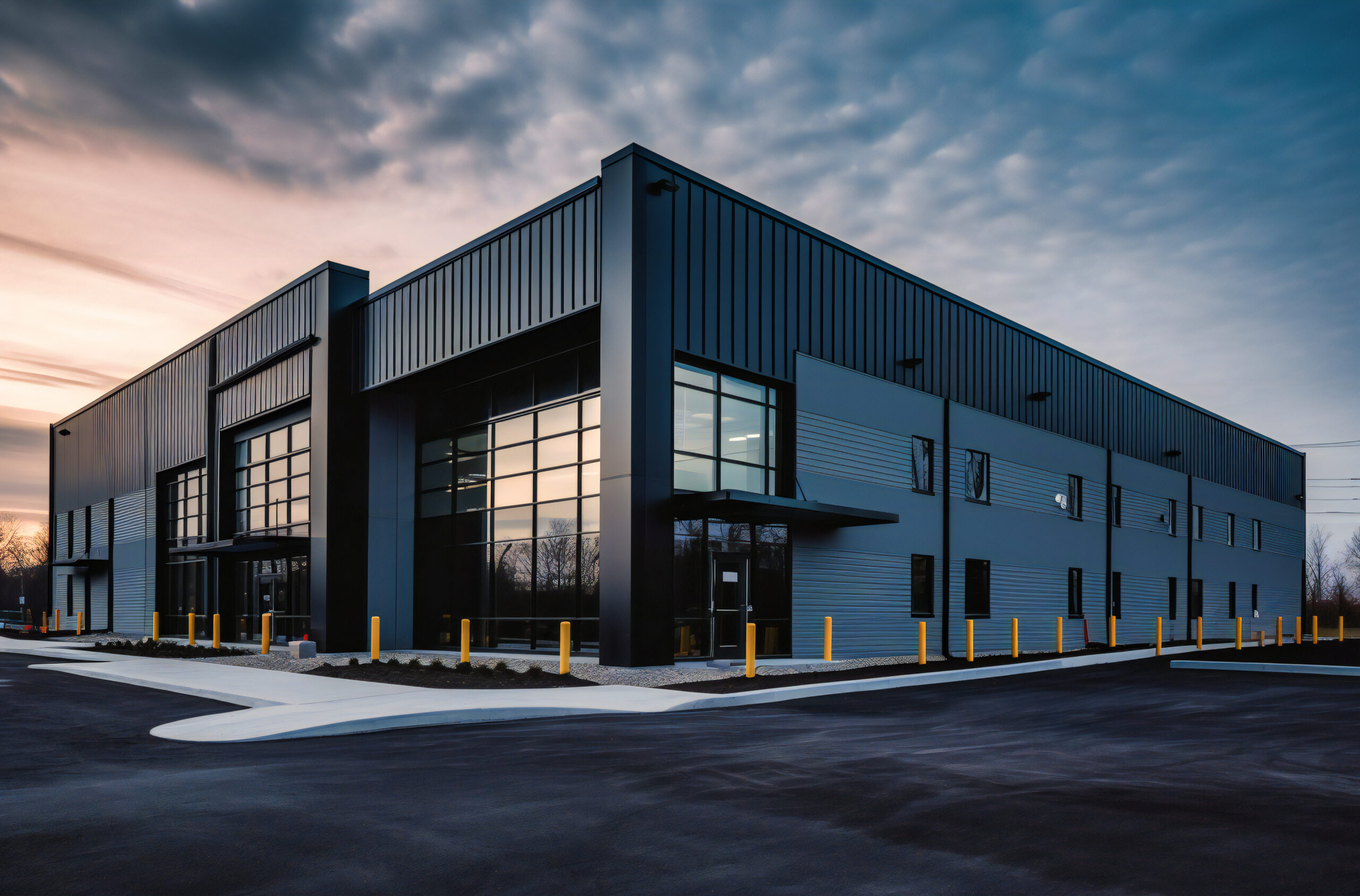
The vision for Eastlink Business Park is to create a master-planned, fully serviced industrial business park in East Balzac, aligned with the County Plan and the East Balzac Area Structure Plan (BEASP). The park will accommodate a mix of light and heavy industrial uses with complementary services to support regional jobs and economic growth.
EASTLINK BUSINESS PARK AT A GLANCE

  • LOCATION: South of HWY 566, East of Range Rd 290.

  • CONNECTIONS: Linkages to HWY 2/Deerfoot Trail & Range Rd 284/Conrich Road.

  • PLAN AREA: ±126.9 hectares (±313.50 acres).

  • POLICY: County Plan (2013), Balzac East Area Structure Plan (BEASP, 2000).

  • TIMELINE: Four Phases (based on approvals, subdivision, servicing capacity & market demands).

About the Project

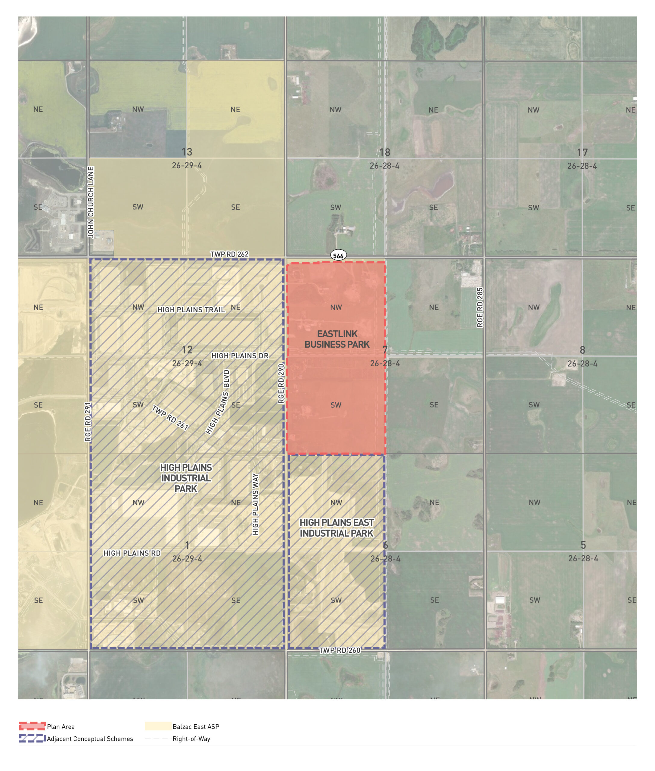
A Conceptual Scheme is a planning document that guides how land will be developed, serviced, and accessed. For Eastlink Business Park, the Conceptual Scheme establishes the land use framework, subdivision concept, servicing approach, transportation network, design direction, and proposed phasing needed to support future development. (Click on map below to enlarge)
Location and Context

The ±126.9 ha (±313.5 ac) plan area is in East Balzac, bordered by Highway 566 to the north, the future extension of Township Road 261 to the south, Range Road 290 (84 Street NE) to the west, and agricultural lands to the east. It is adjacent to High Plains Industrial Business Park (west) and High Plains East Industrial Business Park (south). The site is near major regional transportation routes, including Highway 566, Highway 2/Deerfoot Trail and Range Road 284/Conrich Road.

Development Concept

  • Fully serviced industrial & highway commercial lots

  • Road network with safe access to regional routes

  • Stormwater management facility

  • Landscaping & architectural controls along major roads

Design and Open Space

Architectural controls will guide building form, landscaping, fencing, signage, outdoor storage and exterior lighting. Landscaped areas and pathways are proposed along Highway 566, Range Road 290, Township Road 261 and internal roads. Landscaping and fencing will also provide a transition between the business park and agricultural lands to the east.

* Lotting, roadway layouts and servicing details are conceptual and may change through future subdivision and detailed design.

.
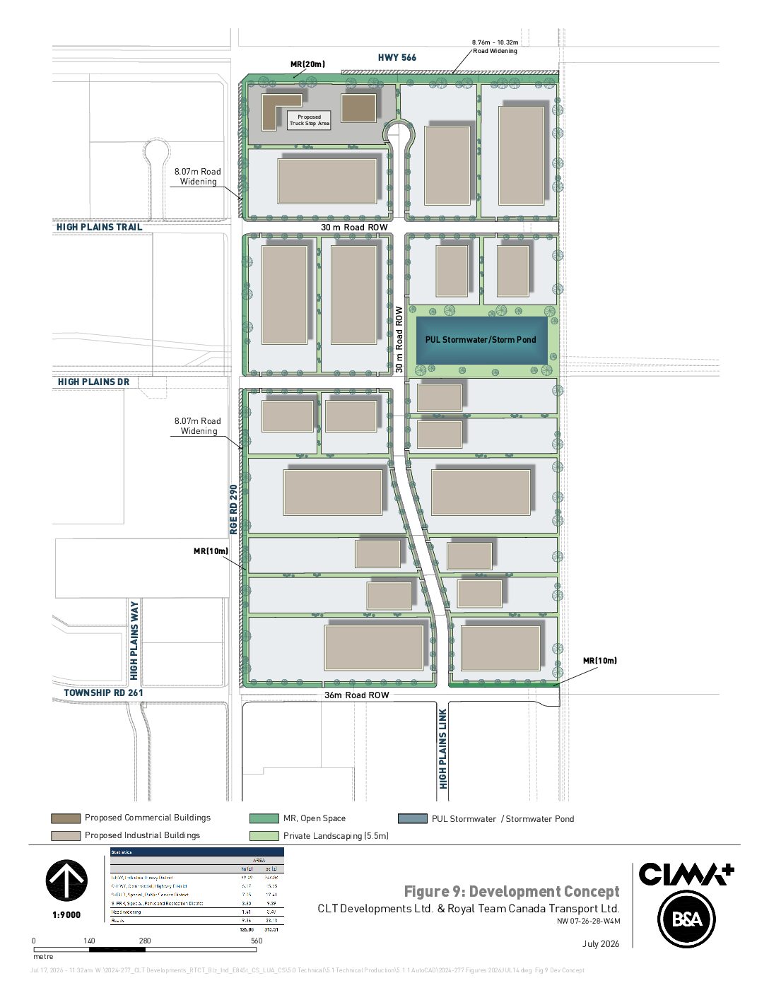
Development Concept

Frequently Asked Questions

The conceptual scheme proposes 22 heavy industrial lots and two highway commercial lots. The industrial area could accommodate a range of industrial, manufacturing, transportation and logistics-related businesses. The businesses permitted on each property will be determined by its land use district and future development permit approvals.

Water will be supplied through Rocky View County’s Balzac water distribution system. An internal water network will be constructed as each phase develops.

Wastewater will be collected through an internal gravity system and a new lift station. It will then connect south through the High Plains East lift station to Rocky View County’s regional wastewater system. Detailed servicing requirements will be confirmed through future subdivision applications.

Stormwater will be managed through a split drainage system. Runoff from the north and central portions of the site will be directed to an on-site stormwater pond. Runoff from the southern portion will connect to the stormwater system in High Plains East. Temporary irrigation areas will also support stormwater management.

Access to the business park is proposed through three intersections on Range Road 290 and one intersection on the future extension of Township Road 261. Direct access from Highway 566 is not proposed. Road widening will be required along portions of Highway 566 and Range Road 290. The timing of road and intersection improvements will be determined through updated transportation analysis completed with future subdivision applications.

Architectural controls will guide landscaping, fencing, signage, outdoor storage and building design. Landscaped areas and pathways are proposed along Highway 566, Range Road 290, Township Road 261 and internal roads. Landscaping and fencing will also help provide a transition to agricultural lands east of the site.

A Business Lot Owners Association will be established to oversee landscaping and pathway maintenance, waste management and the enforcement of architectural controls.

Hours of operation are user-dependent and subject to County bylaws and development permit conditions. Lighting, noise, and screening measures will be addressed through design guidelines, including dark sky guidelines and permit reviews.

Environmental studies completed for the conceptual scheme considered wetlands and waterbodies, former pipelines, existing well sites and existing buildings.

Former pipelines on part of the site were decommissioned in 2022, with soil sampling indicating that further remedial work was not required before development. Two well sites will require further investigation before development activities occur. Additional assessments will also be required for certain existing buildings and for portions of the site that were outside the completed wetland assessment.

Any disturbance of wetlands or waterbodies will be addressed in accordance with provincial requirements and the Alberta Wetland Policy.

Construction timing will depend on Council approval, future subdivision and development permit applications, servicing coordination and market conditions.

The conceptual scheme proposes four main phases, with Phase 2 divided into Phases 2A and 2B. Phase 1 is intended to proceed first because it establishes key transportation, utility and stormwater infrastructure.

Construction access and haul routes will be established through future approvals and construction management plans. These plans will need to follow County requirements and identify appropriate routes for construction traffic.

The conceptual scheme illustrates 24 potential business lots. Final lot sizes and configurations will be determined through future subdivision applications and may change based on servicing requirements, infrastructure and market conditions.

Two highway commercial lots are proposed in the northwest portion of the plan area. These properties may accommodate commercial services that support businesses, employees and visitors. Specific uses will be determined through future development permit applications.

The park is designed for a variety of industrial uses. This includes primarily logistics and operational users seeking access to major transportation routes, as identified in the County Plan and the BEASP.

Please use the Questions and Feedback form or email jgeller@bastudios.ca and your inquiry will be directed to the appropriate team member.

Project Timeline

The timeline is approximate and is subject to Rocky View County’s review and approval process.

Project Resources

Conceptual Scheme

Land Use Redesignation
Hatched Lots are not Included in Land Use Amendment Application.

Questions & Feedback

If you have questions or wish to provide feedback, use the form below. Submissions are delivered directly to the project team. You can also email the project’s Engagement Specialist, Jane Geller at jgeller@bastudios.ca